


|
|
|
|
|
|
|
|
| LITTLE RIVER REGIONAL PARK: | |
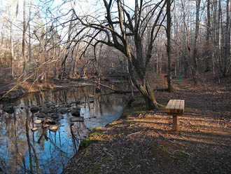 |
 Not exactly ON the Eno River, but the Little River empties into the Eno west of Falls Lake, and is a nice hike within a few miles of Durham - plus they have designated Mountain Bike Trails, too. The designated hiker trails do not permit the bikes on it, so it remains a peaceful hike. The recommended route to take in much of the trail system, is to leave the parking area on the Ridge Trail, accessed near the bathrooms pavilion, and turn right onto the South River Loop Trail, descend down to the Little River, walk upstream along the river to the north, then it will turn left (west) and connect with a connector trail back to the Ridge Trail. Follow it to the large trailhead-looking kiosk, and make a loop to the river, either direction because it loops back to this point - then return to the parking area.
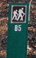
It is not blazed, but they have sporadic trail signs like above at critical intersections. I have not done the Homestead Trail, so I cannot describe it yet.
|
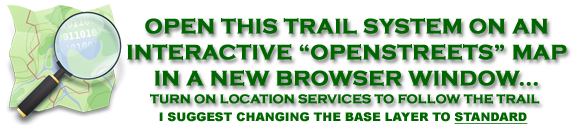
Using this link to the right, you should be able to open an OPENSTREETS Map centered on the area. I strongly suggest changing your base layer to STANDARD to see the latest trails. If your location services are active you can center the map on your current location, and follow the trails on the map. |
|
 BASEMAP COPYRIGHT GOOGLE MAPS; OVERLAY DATA COPYRIGHT EnoTrails.com RIGHT CLICK & "VIEW IMAGE" or "OPEN IN NEW TAB" TO DISPLAY FOR PRINTING JUST THIS MAP. |
|
|
ver. 3.1 ~ © 2011-
|